Two Wheels Magazine
On the War Path
by Digby Greenhalgh


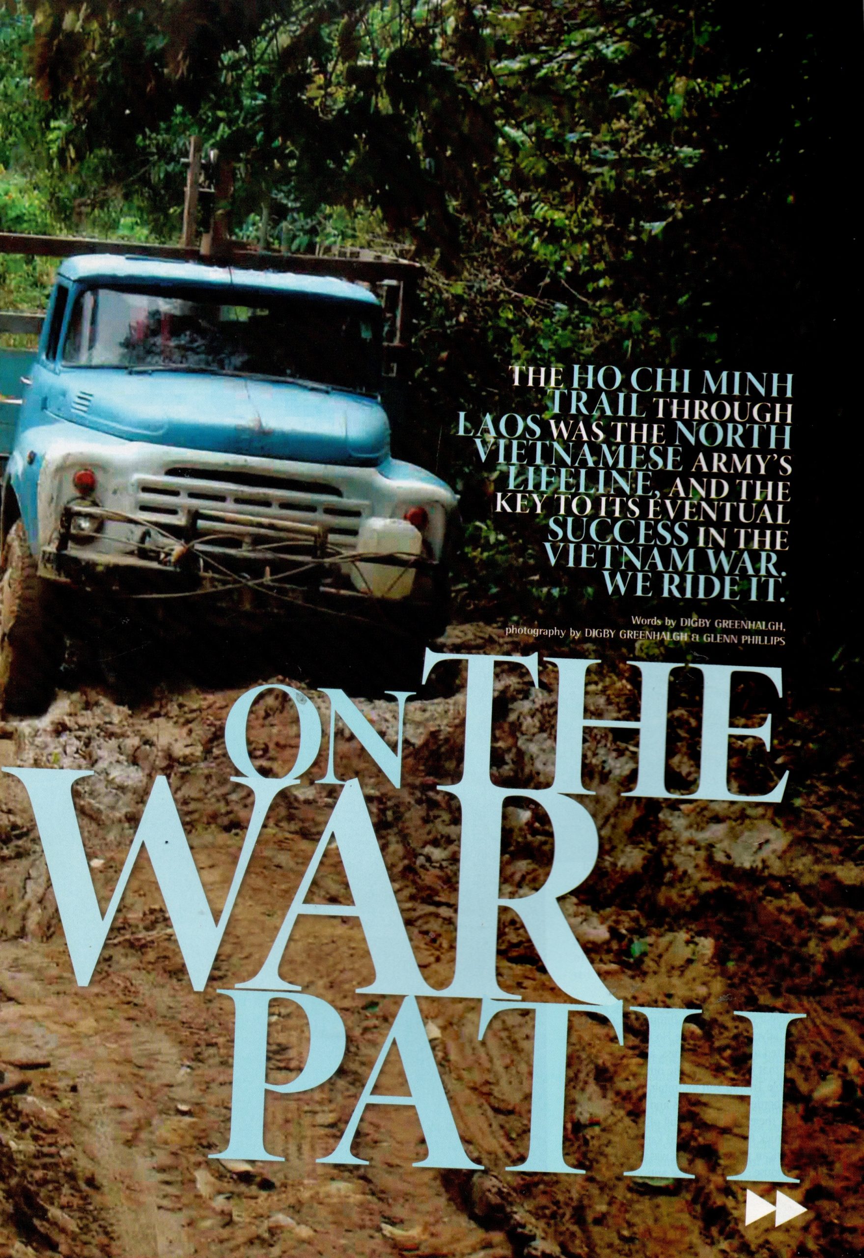
On the War Path
You have to watch your step in the jungles of Laos. We were in a small cave a few metres off one of the main branches of the Ho Chi Minh Trail, when we saw a small disc sitting out in the forest. It was an anti-personnel land mine, and it was probably live.
Bits of broken Vietnamese crockery in the cave showed someone had once sheltered there, and the land mine showed they had meant business. Not far from the land mine, we found a fragment of the oil pipeline that had carried oil all the way from Vinh on the North Vietnamese coast, through the Lao jungles and down to the South Vietnamese battlefields.
The Chokes, Laos
We were right in the middle of the Chokes, where two major branches of the Ho Chi Minh Trail intersected in a rugged, heavily forested range of limestone mountains. The mountains, rivers and jungles offered plenty of cover for Vietnamese trucks, but also gave American pilots a natural chokepoint where targeted bombing could halt the flow of soldiers and supplies down the Trail.
Laos is the most-heavily bombed country, per capita, in the world, and the Chokes is one of the most heavily bombed places in that country. We decided to get out of there, but before we rode the narrow, rocky trail that ran through the jungle, we looked at a US reconnaissance photo taken of the Chokes during the war. It looked like the moon.
Bomb Clearance and Scrap Dealers
When we came out on the sealed highway that runs through Vilabury, we met up with two former Australian sailors who were now working on bomb clearance for a massive Australian-run goldmine. The hills near Vilabury are home to thousands of tonnes of gold, copper and unexploded ordnance (UXO). They said that the heaviest bombs dropped by B52s lie deep beneath the surface, while cluster bombs, landmines and gravel mines lie close to the top.
On the other side of the road, Vietnamese scrap metal dealers were buying bombs, mortars and truck parts from any local villagers who owned a cheap metal detector. The Lao sell their scrap metal for about 20c (Australian) a kilo, and the Vietnamese sell it on for twice as much. The boys from the mine estimated that up to 6,000 people still die in Laos each year from UXOs, and many of them are looking for lucrative scrap metal.
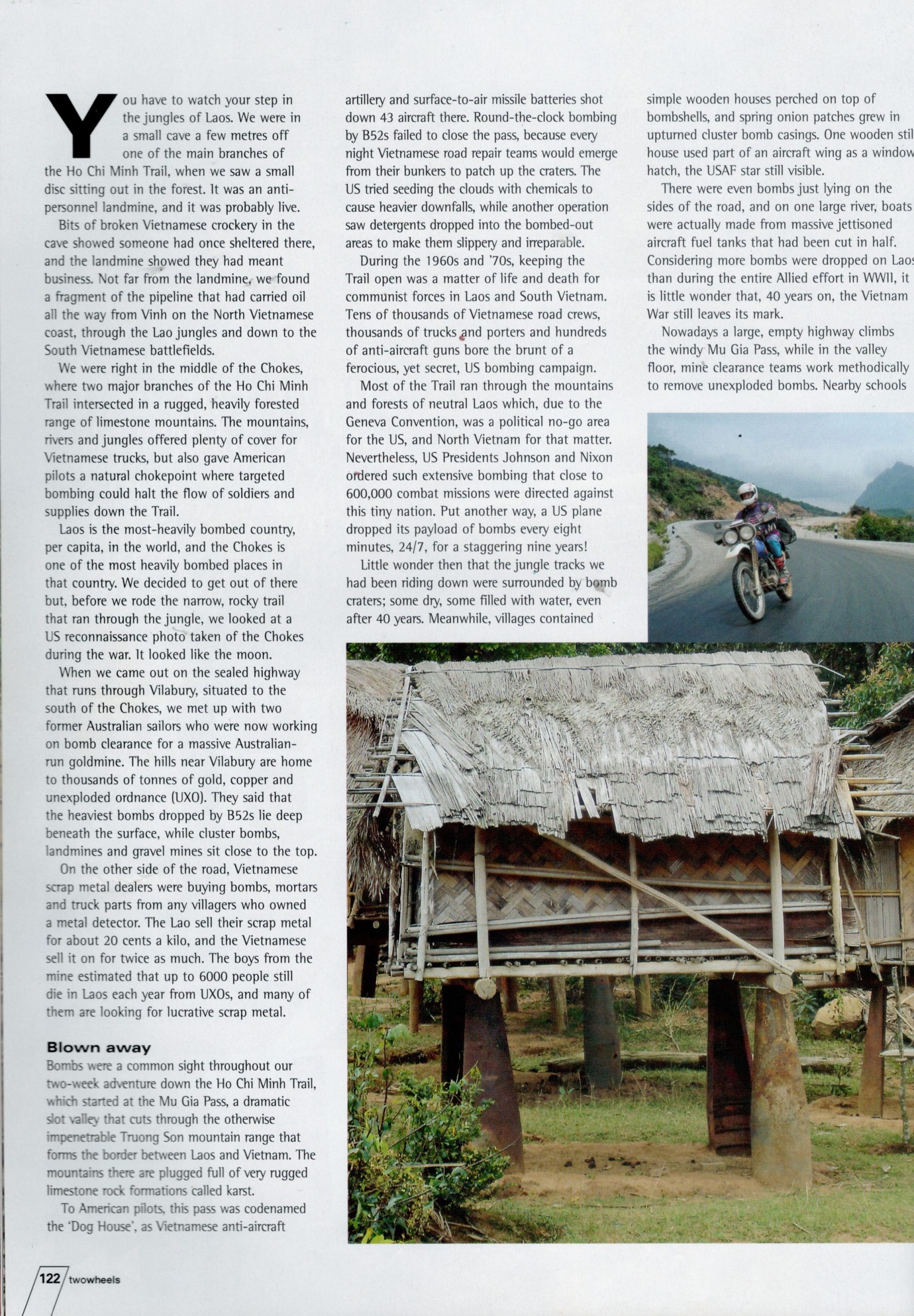
Bombs were a common sight throughout our two-week adventure down the Ho Chi Minh Trail, which started at the Mu Gia pass, a dramatic slot valley that cuts through the otherwise impenetrable Truong Son mountain range that forms the border between Laos and Vietnam. The mountains there are plugged full of very rugged limestone rock formations called karst. To American pilots, this pass was codenamed the “Dog House”, as Vietnamese anti-aircraft artillery and surface-to-air missile batteries shot down 43 planes and rescue helicopters there. Round-the-clock bombing from B52s failed to close the pass, because every night Vietnamese road repair teams would emerge from their bunkers to patch up the craters. The US even tried seeding the clouds with chemicals to cause heavier downfalls, while another operation saw detergents dropped into the bombed-out areas in order to make them slippery and irreparable.
The Ho Chi Minh Trail and the American War
During the sixties and seventies, keeping the Trail open was a matter of life and death for communist forces in Laos and South Vietnam. Tens of thousands of Vietnamese road construction and repair teams, thousands of trucks and porters and hundreds of anti-aircraft guns bore the brunt of a ferocious, yet secret, US bombing campaign. Most of the Trail ran through the mountains and forest of neutral Laos, which due to the Geneva Convention was a political no-go area for America. Nevertheless, Presidents Johnson and Nixon ordered such extensive bombing that close to 600,000 combat missions were directed against this tiny nation. Put another way, a US plane dropped its payload of bombs every eight minutes, around the clock, 24/7, for a staggering nine years!
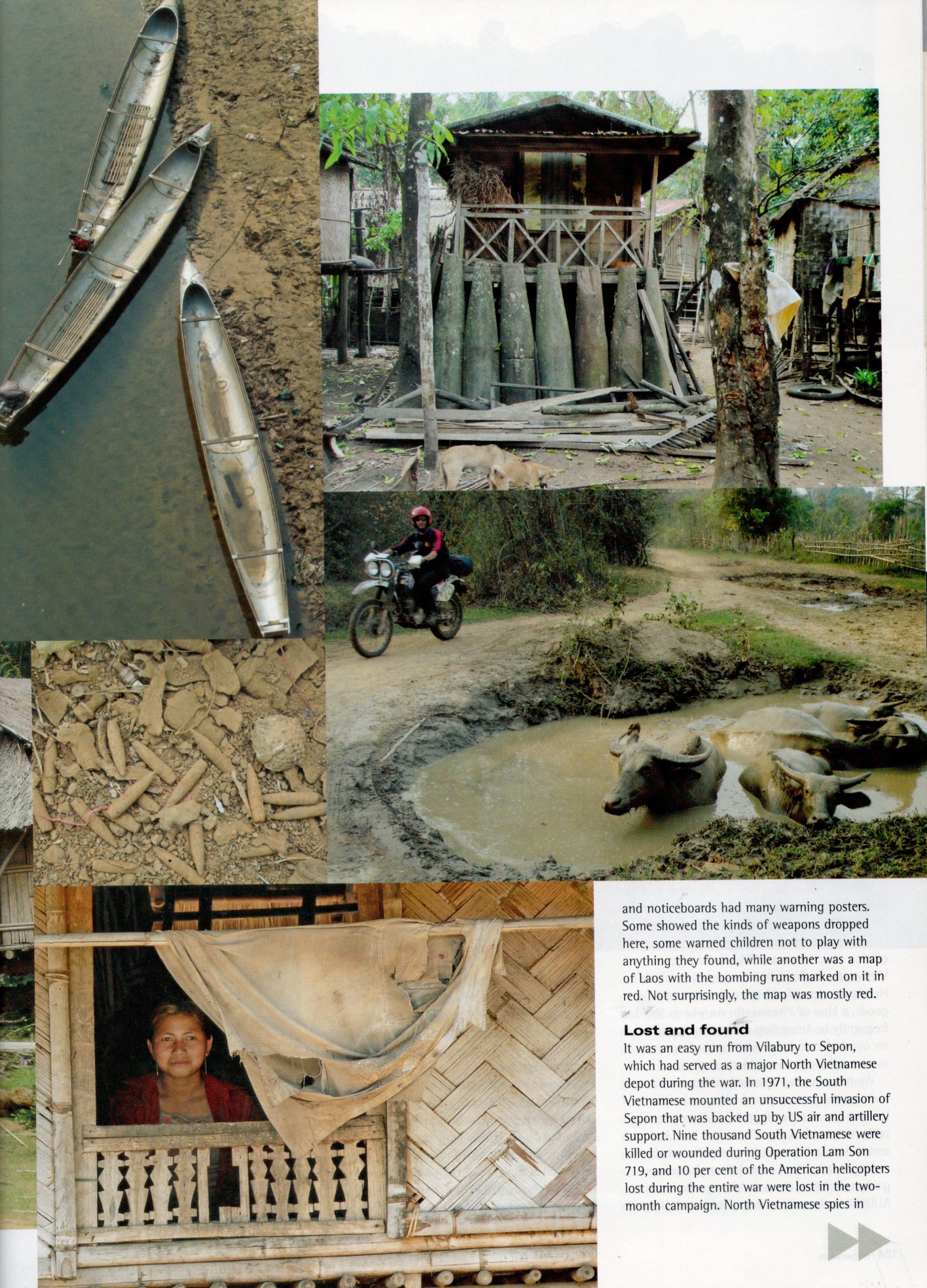
Little wonder then that the jungle tracks we had been driving down were surrounded by bomb craters, some dry, some filled with water, even after forty years. Meanwhile, villages contained simple wooden houses perched on top of bomb shells, and spring onion patches grew in upturned cluster bomb casings. There were even bombs just lying on the sides of the road, and on one large river, boats were actually made from massive jettisoned aircraft fuel tanks that had been cut in half. Considering more bombs were dropped on Laos than during the entire Allied effort in WWII, it is little wonder that forty years on, the Vietnam War still leaves its mark.
Nowadays, a large empty highway climbs the windy Mu Gia pass while in the valley floor, mine clearance teams work methodically to remove unexploded bombs. Nearby schools and noticeboards had many warning posters. Some showed the kinds of weapons dropped here, some warned children not to play with anything they found, while another was a map of Laos with the bombing runs marked on it in red, which not surprisingly, was mostly red.
MIA Personnel
It was an easy run from Vilabury to Sepon, which had served as a major North Vietnamese depot during the war. In 1971, the South Vietnamese mounted an unsuccessful invasion of Sepon that was backed up by US air and artillery support. Nine thousand South Vietnamese were killed or wounded during Operation Lam Son 719, and 10 per cent of the American helicopters lost during the entire war were lost in the two-month campaign. North Vietnamese spies in Saigon and scouts in the hills had given the communists plenty of warning.
Unfortunately all the decent hotels in Sepon were fully booked out by a team of 50 American MIA (Missing in Action) personnel, who were on the hunt for four aircraft crash sites. About 540 US aircraft of all types were lost over Laos during the war. Rescue efforts at the time were remarkably successful, and some 60 per cent of downed pilots were extracted. All crash sites were recorded but sometimes the severity of the crash, the lack of a parachute or the density of AAA cannon fire prevented a successful rescue. Every year, the MIA teams recover the remains and or circumstantial evidence of the missing pilots such as dog tags, engraved wedding rings, bone fragments and clothing that, after exhaustive analysis in the US, allow them to move a pilot’s name from the MIA to the KIA list.
Navigating the Trail
We continued southwards and spent a day pushing tracks towards Ta Oi, another important junction during the war, which unfortunately always petered out into walking paths. The jungle, it seemed, had retaken this part of the Trail. There were hundreds of oil drums scattered along the sides of the Trail, and houses were even perched up on them. Many were peppered with bullet holes. I looked at a Vietnamese map of the Trail and found that there were three major depots hidden there during the war. The Vietnamese called these depots “binh trams’ and there were about 30 stretched out evenly along the Trail. Each was a semi-autonomous unit, boasting hospitals, truck storage areas, repair shops, fuel depots and sleeping quarters. Each night the heavily camouflaged trucks would be loaded up with supplies that had been dispersed in underground bunkers during the day. First out were armoured vehicles whose job it was to set off any magnetic delay mines dropped on the Trail during the day. They drove quickly. The next binh tram would be a night’s drive away. Drivers only drove one section, back and forth, so were intimately aware of the conditions. Around three in the morning they would arrive, the trucks would be parked in hillside bunkers while the supplies would again be dispersed underground.
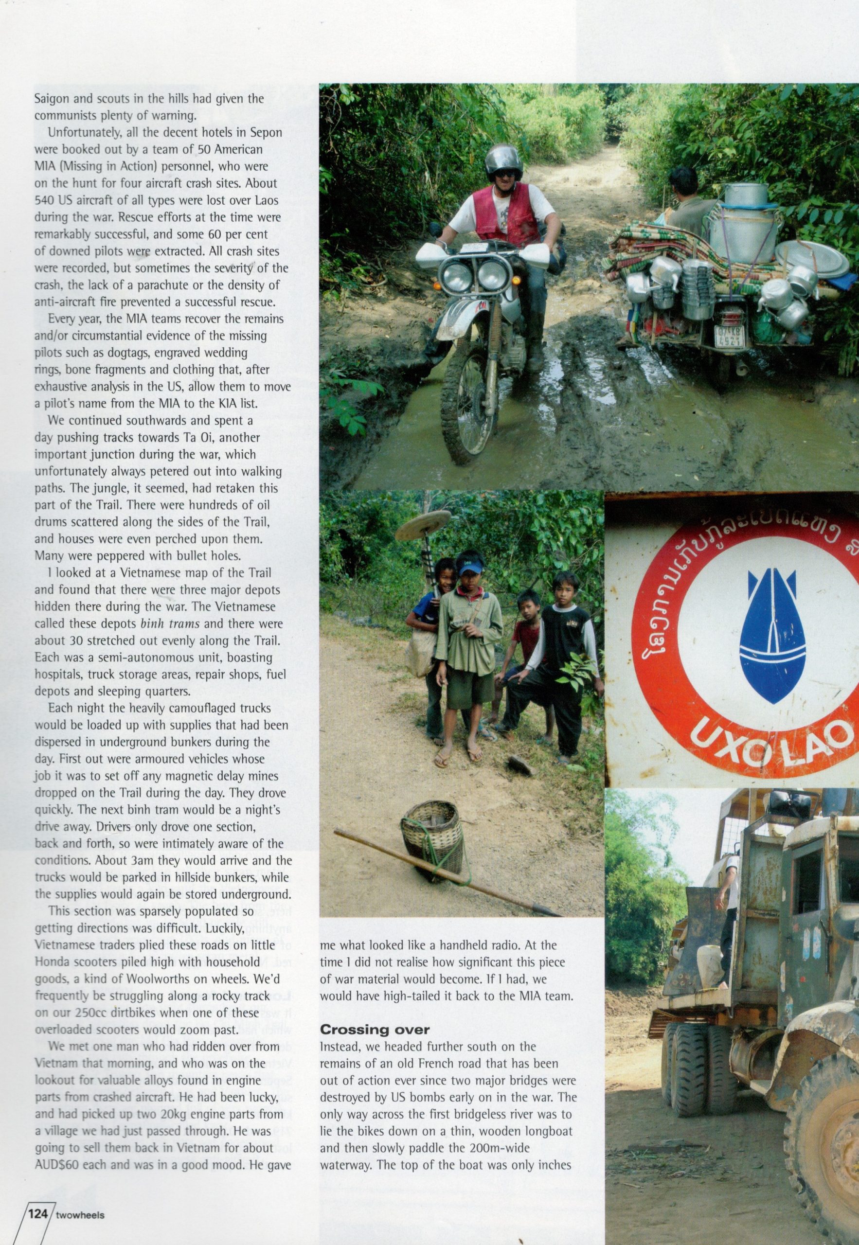
This section was sparsely populated so getting directions was difficult. Luckily, Vietnamese traders plied these roads on little Honda scooters piled high with household goods, a kind of Woolworths on wheels. We’d frequently be struggling along a rocky track our 250cc dirt bikes when one of these overloaded scooters would zoom past. We met one man who had driven over from Vietnam that morning, and who was on the lookout for valuable alloys found in engine parts from crashed aircraft. He had been lucky, and had picked up two 20-kilo engine parts from a village we had just passed through. He was going to sell them back in Vietnam for about A$60 each and was in a good mood. He gave me what looked like a handheld radio. At the time I did not realise how significant this piece of war material would become, and if I had, we would have high-tailed it back to the MIA team.
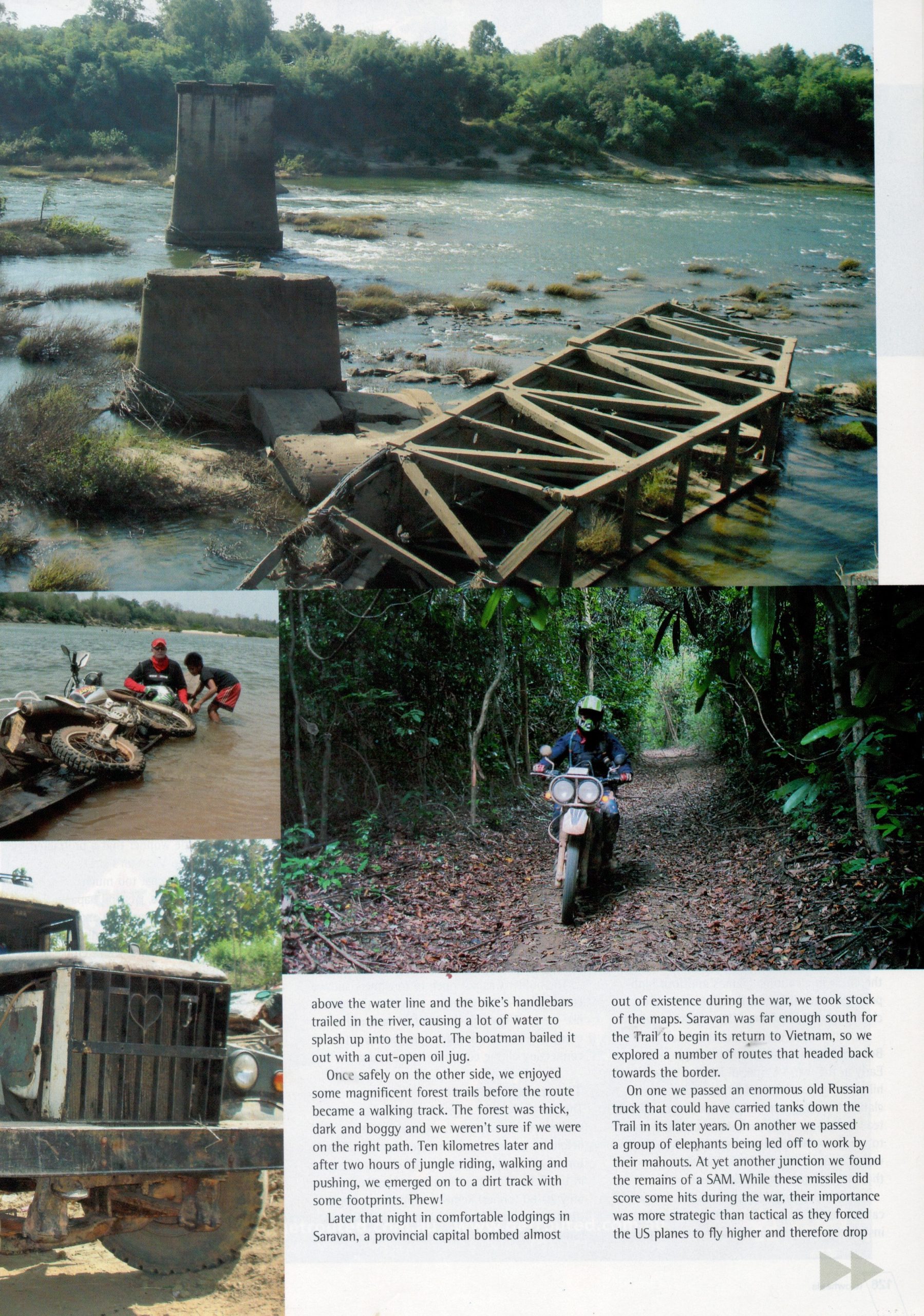
Instead we headed further south on the remains of an old French road that has been out of action ever since two major bridges were destroyed by US bombs early on in the war. The only way across the first bridge-less river was to lie the bikes down on a thin wooden long boat and then slowly cross the 200-metre-wide river. The top of the boat was only inches above the water line and the bike’s handlebars trailed in the river, causing a lot of water to splash up into the boat. The boatman bailed it out with a cut-open oil jug. Once safely on the other side, we enjoyed some magnificent forest trails before the way really became a walking track. The forest was thick, dark and boggy and we were not sure if we were on the right track. Ten kilometres later and two hours worth of jungle driving, walking and pushing, we emerged back onto just a dirt track with some foot prints. Phew!
Later that night in comfortable lodgings in Saravan, a provincial capital bombed out of existence during the war, we took stock of the maps. Saravan was far enough south for the Trail to begin its return to Vietnam so we explored a number of routes that headed back towards the border. On one we passed an enormous old Russian truck that could have been used to carry tanks down the Trail in its later years. At another junction we found the remains of a SAM missile. While these missiles did score some hits during the war, their importance was more strategic than tactical as they forced the US planes to fly higher and therefore drop their bombs more inaccurately.
Operation Hunt
During the later parts of the war, the Americans launched a number of seasonal campaigns, all called Operation Hunt. The stated objectives were to target trucks, the Trail, the bases and AAA/SAM sites but the real mission was to delay an invasion of South Vietnam and to make the North Vietnamese pay in blood for their effort. During such campaigns there could easily be up to 300 sorties every day. A particularly lethal US aircraft was the propeller driven C-130 gun ship, called the “Spectre”. Kitted out with night vision, heat and magnetic detectors, the latest in electronic gizmos and four high-powered machine guns, these planes could circle their targets firing 5,000 rounds a minute.
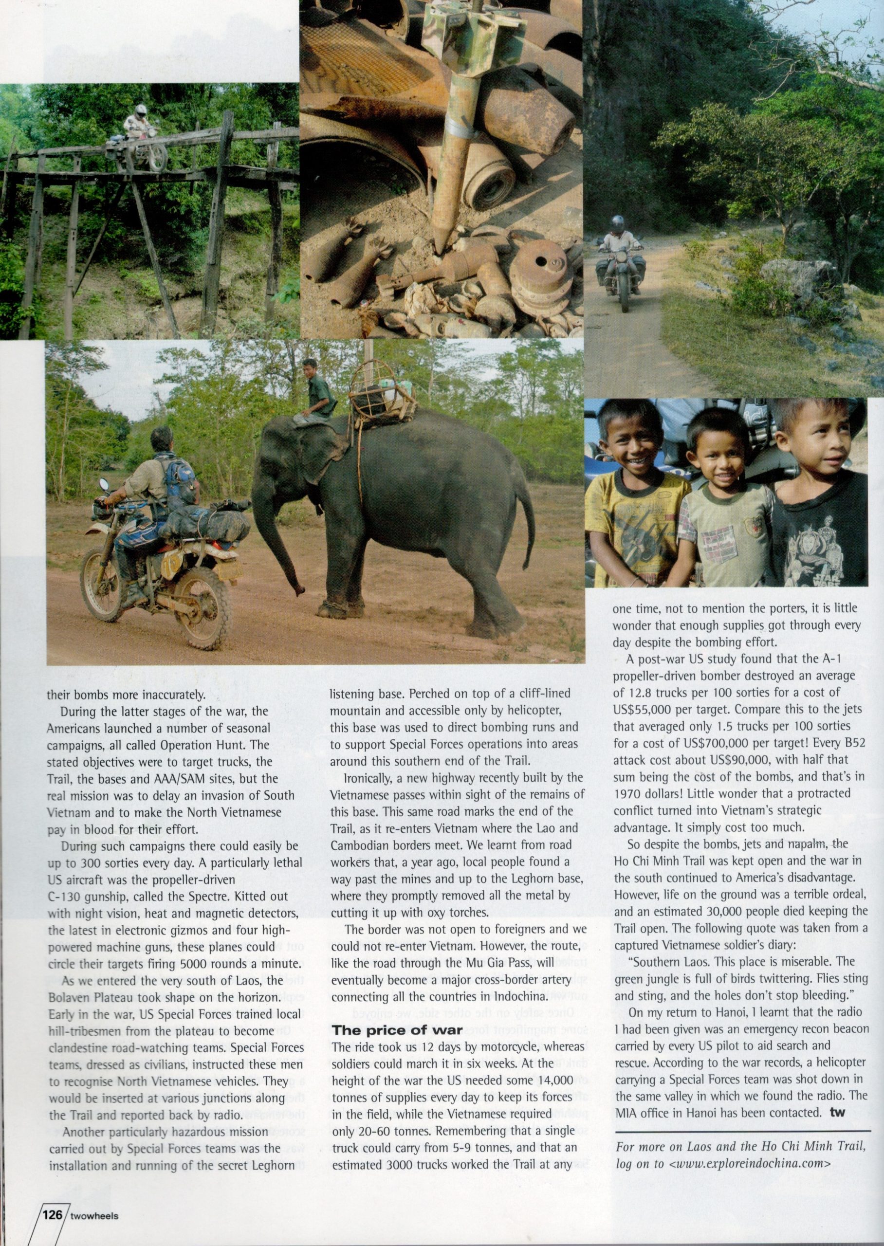
As we entered the very south of Laos, the Bolaven Plateau began to take shape on the horizon. Early on in the war, US Special Forces had trained local hill-tribe men from this plateau to become clandestine road-watching teams. Special Forces teams, dressed as civilians, instructed these men to recognise North Vietnamese vehicles. They would be inserted at various junctions along the Trail and reported back by radio. Another particularly hazardous mission carried out by Special Forces teams was the installation and running of the secret Leghorn listening base. Perched on top of a cliff-lined mountain and accessible only by helicopter, this base was used to direct bombing runs and to support Special Forces operations into areas around this southern end of the Trail.
Ironically, a new highway recently built by the Vietnamese passes within sight of the remains of this base. This same road marks the end of the Trail, as it re-enters Vietnam where the Lao and Cambodian borders meet. We learnt from road workers that a year ago, local people found a way past the mines and up to the Leghorn base, where they promptly removed all the metal by cutting it up with oxy torches. The border was not open to foreigners and we could not re-enter Vietnam. However the route, like the road through the Mu Gia pass, will eventually become a major cross-border artery connecting all the countries in Indochina.
The MIA Office Has Been Contacted...
The ride took us 12 days by motorbike, whereas during the war soldiers could march it in six weeks. While at the height of the war the US needed some 14,000 tonnes of supplies every day to keep its forces in the field, the Vietnamese required only 20-60 tonnes. Remembering that a single truck could carry from 5-9 tonnes and that an estimated 3,000 trucks worked the Trail at any one time, not to mention the porters, it is little wonder that enough supplies got through every day despite the bombing effort.
A post-war US study found that the A-1 propeller-driven bomber destroyed an average of 12.8 trucks per 100 sorties for a cost of US$55,000 per target. Compare this to the jets that averaged only 1.5 trucks per 100 sorties for a cost of US$700,000 per target! Every B52 attack cost about US$90,000, with half that sum being the cost of the bombs, and that’s in 1970 dollars! Little wonder that a protracted conflict turned into Vietnam’s strategic advantage. It simply cost too much.By waging a low-tech war effort that saw the widespread dispersal of trucks and supplies, the Vietnamese denied the US any lucrative targets. A road is a difficult target, especially when tens of thousands of road repair crews were willing to brave mines, cluster bombs and delayed-fuse bombs to keep it open. Trucks were even harder to hit, especially when they were heavily camouflaged, driven at night by experienced crews, on trails that had triple-layered canopies of cover. So despite the bombs, jets and napalm, the Trail was kept open and the war in the south continued to America’s disadvantage. However, life on the ground was a terrible ordeal, and an estimated 30,000 people died keeping the Trail open. The following quote was taken from a captured Vietnamese soldier’s diary:
“Southern Laos. This place is miserable. The green jungle is full of birds twittering. Flies sting and sting, and the holes don’t stop bleeding.”
Upon my return to Hanoi, I learnt that the radio was an emergency recon beacon carried by every US pilot to aid search and rescue. According to the war records, a helicopter carrying a Special Forces team was shot down in the same valley we found the radio. The MIA office in Hanoi has been contacted.
More Articles

ADV Rider Magazine
by Sean Goldhawk

Rider Magazine
by Perri Capell

TIME Magazine Asia
by Kay Johnson